
3D Scan Mapping for Property Insurance Claims in Baltimore, MD
When property damage affects a home or business, photographs alone may not always show how rooms, structures, and damaged areas connect. Mid Atlantic Public Adjusters provides 3D scan mapping in Baltimore, MD, to create detailed digital records that can support the documentation of residential and commercial property insurance claims.
Using Matterport 3D scanning technology, we can capture the layout and condition of a property in an interactive digital model. This can be especially useful after fire, water, storm, or other significant property damage where documenting multiple rooms, measurements, and affected areas is an important part of preparing the insurance claim.
What Is Matterport 3D Scan Mapping?
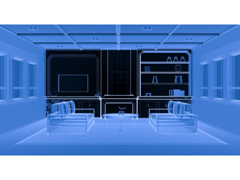
Matterport technology captures images and spatial measurements throughout a property and combines them into a navigable 3D digital model. Instead of relying only on individual photographs, a scan can provide a more complete view of rooms, walls, floors, ceilings, hallways, and the relationship between different areas of the property.
For insurance claims, this creates a visual record that can help document the condition and layout of a damaged property. The digital model can also be reviewed remotely, which may make it easier for the different professionals involved in a claim to understand the affected areas.
3D scanning does not replace photographs, estimates, inventories, or other claim documentation. It adds another layer of information that can be particularly valuable when the property loss is large or complicated.
How 3D Scanning Supports Property Insurance Claims
A property claim depends heavily on documentation. Matterport scanning can supplement photographs, estimates, measurements, and other records by creating a detailed visual representation of the property after a loss.
Document the Property Layout
A 3D model shows how rooms and affected areas connect. This can provide useful context when damage extends through multiple rooms, floors, or sections of a building.
Preserve a Visual Record
Repairs and cleanup can change the condition of a property quickly. A scan can preserve a digital record of the space and visible conditions documented at the time the scan was completed.
Capture Multiple Affected Areas
Large losses may involve damage to several rooms or different parts of a commercial property. 3D mapping can help organize those areas within one digital model rather than relying on disconnected photographs.
Provide Spatial Measurements
Matterport technology can capture measurements and spatial information that may be useful when documenting rooms, structures, and other features involved in the property loss.
Share Property Information Remotely
A digital model can be viewed without every person involved in the claim having to be physically present at the property, giving reviewers another way to understand the space and documented conditions.
Support a More Organized Claim
When combined with estimates, photographs, inventories, and other supporting information, 3D mapping can become part of a broader documentation package used to present the property loss.
Useful for Large & Complicated Property Losses
Not every insurance claim requires 3D scanning. For a small, isolated loss, conventional photographs and measurements may provide the documentation needed. The technology becomes particularly useful when the damaged property is larger, the loss extends across several areas, or understanding the physical relationship between damaged spaces matters.
Examples may include multi-room water losses, extensive fire damage, commercial buildings, large residential properties, multi-level structures, and losses where cleanup or reconstruction may significantly alter the property after the initial inspection.
Our broader insurance adjusting services combine property documentation with claim preparation, damage evaluation, carrier communication, and other assistance based on the circumstances of the loss.
3D Documentation for Different Types of Property Damage
Fire & Smoke Damage
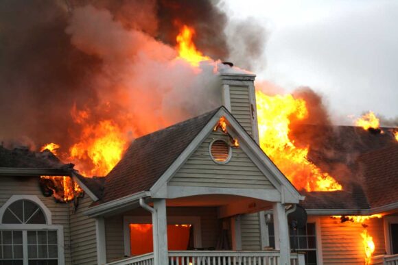
A significant fire can affect structural materials, interior finishes, contents, multiple rooms, and areas exposed to smoke or firefighting efforts. A 3D scan can help preserve a broader visual record of the affected property.
Water Damage
Water can move through walls, ceilings, flooring, and adjoining rooms. Mapping the property can provide useful context when documenting how widespread a water-related loss has become.
Roof & Storm Damage
Roof damage can lead to problems in multiple interior areas, particularly when wind or rain creates openings that allow water into the structure. Thorough documentation helps connect the exterior event with the affected spaces inside.
Wind & Rain Damage
Severe weather may affect siding, roofing, windows, exterior structures, and several areas inside a building. A 3D model can help document the overall layout when damage is spread throughout the property.
3D Scanning for Residential Property Claims
When a home suffers extensive damage, the claim may involve several bedrooms, bathrooms, living spaces, storage areas, basements, garages, or other parts of the property. A digital model gives the claim another form of documentation that shows how these spaces fit together.
This can be especially helpful when damaged materials need to be removed quickly or when major repairs will significantly alter the condition of the home. Capturing the property before those changes occur can preserve useful visual information about the space.
3D Scanning for Commercial Claims
Commercial properties can contain offices, retail areas, storage rooms, equipment spaces, inventory, production areas, and other sections that make a large loss difficult to document with individual photographs alone.
A Matterport model can create a more navigable representation of the property and help establish where affected areas were located. We can combine this documentation with other information used when evaluating commercial property and applicable business-related losses.
3D Mapping Is One Part of Thorough Claim Documentation
A digital scan can be useful, but a strong property claim is built from multiple forms of supporting information. Depending on the loss, documentation may also include photographs, repair estimates, measurements, damaged contents inventories, receipts, invoices, property records, and other materials related to the claimed damage.
As public adjusters, we look at the larger picture. We can help inspect the property, document the loss, organize supporting information, evaluate damages, and communicate with the insurance company while using technology such as 3D scanning when it adds meaningful detail to the claim.
When Should a Property Be Scanned?
When 3D mapping is appropriate, documenting the property before major cleanup, demolition, or reconstruction can help preserve information about its condition after the loss. The circumstances of every claim are different, so the right timing depends on the property, the damage, safety conditions, and the work that needs to occur.
Property owners often contact us after damage has occurred but before extensive restoration begins. We can review the situation and determine what documentation methods may be useful for the claim.
If repairs or cleanup have already started, that does not automatically mean useful documentation is impossible. Existing photographs, estimates, records, remaining damage, and other evidence may still help establish what occurred.
Already Have an Insurance Claim Open?
3D scanning is not limited to claims that have not yet been filed. If your insurance claim is already underway and the property still contains damage that would benefit from more detailed documentation, we can review the circumstances and determine whether creating a digital model would be useful.
We also assist policyholders whose claims have become delayed, disputed, or more complicated than expected. In those situations, better organization and additional documentation may help clarify the property loss and the issues being discussed with the carrier.
Detailed Property Documentation for Baltimore Claims
Mid Atlantic Public Adjusters provides 3D scan mapping and property insurance claim assistance for homeowners and businesses throughout Baltimore and surrounding Maryland communities. Our team is based in Parkton in northern Baltimore County and assists policyholders throughout the region.
If your property has suffered a significant loss, we can discuss the damage, the current status of your insurance claim, and whether Matterport scanning could provide useful additional documentation.
Call Mid Atlantic Public Adjusters:
(410) 961-6770
Frequently Asked Questions
What is Matterport 3D scanning?
Matterport scanning captures images and spatial information throughout a property and combines them into an interactive digital 3D model. The result provides a more complete view of the property’s layout than individual photographs alone.
How can a 3D scan help with an insurance claim?
A 3D scan can provide an additional visual record of the property, show how affected areas connect, preserve information about the property’s condition, and supplement other claim documentation such as photographs, measurements, inventories, and estimates.
Does 3D scanning replace a property inspection?
No. 3D scanning is a documentation tool. It can supplement a property inspection and other supporting materials, but it does not replace the broader work needed to evaluate and prepare an insurance claim.
When should I have my damaged property scanned?
When appropriate and safe, documenting the property before extensive cleanup, demolition, or reconstruction may help preserve a record of its condition after the loss. The right timing depends on the circumstances of the particular property and claim.
Can you scan commercial properties?
Yes. 3D mapping can be useful for both residential and commercial properties, particularly when a building contains multiple rooms, floors, departments, storage areas, or other spaces affected by the loss.
Can you provide 3D mapping if my insurance claim has already started?
Potentially, yes. If relevant property damage is still available to document, we can review the circumstances and determine whether a 3D scan could add useful information to an existing insurance claim.
Document Your Property Loss in Greater Detail
When a property insurance claim involves extensive damage, having a clear record of the affected space can become an important part of organizing the loss. At Mid Atlantic Public Adjusters, we combine detailed property documentation with experienced public adjusting services for Baltimore homeowners and businesses. Contact us to discuss your loss and whether 3D scan mapping is appropriate for your claim.